|
|
Second Workshop for an Integrated Tsunami Scenario Simulation
October 29 and 30
The Westin,
San Francisco Airport, CA
Sponsored by National Science Foundation
CMS û 0321889
Background
Tsunamis are very rare events, which makes determining their behavior and characteristics extremely difficult. The effects of tsunamis are not predictable based on our experience from normal storm-wave phenomena. Unlike direct seismic effects, where ground shaking is practically concurrent with fault rupture, there is usually a short lead-time for predicting tsunami attack after receiving a seismic signal, which makes effective warning and evacuation possible. This lead-time can range from a few minutes for a local source to ten or more hours for a distant source. Tsunami warning lead-times are much shorter than those of many other natural hazards (e.g. volcanic eruptions, hurricanes, and floods); however, adequate and effective evacuation can minimize loss of life from these very rare natural hazards.
A scenario simulation is a case study, in either a real or hypothetical background setup, where tsunami phenomena and effects are simulated for given geographical, seismological, geological, and societal conditions. Simulations must be comprehensive and integrate not only tsunami generation, propagation, runup motion (flow velocities and inundation), and flow-structure interactions, but also other types of simulations such as warning transmission to the public, evacuation, environmental impacts, rescue tactics, and short-term and long-term recovery strategies. The simulation exercises should include physical models, numerical models, informatics, human behavior, communication simulations, and other exercises that will integrate the tsunami source with its eventual effects on communities and the environment. Clearly, this activity is by nature a multi-community and multi-disciplinary effort.
It is not our immediate objective to determine specific tsunami mitigation measures for individual coastal towns and cities. Instead, a scenario for a hypothetical but realistic situation (which could be based on an existing real coastal community) should be designed that will circumvent the potential social and political concerns of a direct study of a specific location. By setting up a hypothetical scenario, researchers from a wide variety of disciplines can investigate a common problem from different perspectives, encouraging each researcher to interact closely with researchers in other areas. This will help researchers gain a broader picture for research, identify critical problems, and identify linkages to be examined for improvement.
An additional and important benefit of the use of a hypothetical scenario is to provide a better means for technology transfer from basic research. Academic research results are generally published in academic journals, but not seen by broader audiences that might be interested in the potential usefulness of the results. The hypothetical scenarios would encourage researchers to validate their models based on the ideal and common scenario so that results could be compared and disseminated effectively to a broader community.
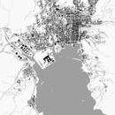
Our pilot simulations are presented in a GIS framework (see Example ) . Improvement in visualization of the simulations will provide an effective means for educating the general public. Ultimately, the advanced visualization may be used for providing a virtual experience at the personal level based on a virtual tsunami event. For example, a person could potentially play the role of an evacuee at ground level in the simulation as a learning tool; since it is not feasible to rely on real exposure to tsunamis, a virtual experience will be valuable.
The development of tsunami scenario simulations also has another added and important benefit. Although our major focus is on tsunamis, once the system is developed it can be used for a wide variety of applications related to other natural, as well as human-made, hazards (e.g. tornados, hurricanes, floods, and fires). This sort of systematic integration of multi-disciplinary simulations is essential for hazard mitigation-oriented research.
This is the second of a series of three workshops to initiate, develop, coordinate, and sustain the community effort for scenario simulations for tsunami hazard mitigation. The first workshop was designed to initiate the simulation effort, the second workshop will act as a catalyst to expand those activities, and the third will focus on the applications and the use of the developed system.
Workshop
At the 2003 workshop , held at Oregon State University on August 8, 2003 , we discussed two main topics: 1) development of a virtual coastal community for scenario simulations, and 2) strategies to initiate integrated scenario simulations. As the first step, the workshop recommended establishment of a GIS database for a virtual coastal community so that each investigator could begin applying his/her simulation model. The GIS layers should include, but are not limited to: geophysical data (bathymetry, topography, geology); built environment (e.g., harbor facilities, buildings, roads, and utilities); demographics, including human behavior; disaster planning and economics (land use, occupancy rates, etc.).
The working group is currently collecting existing GIS information for several real coastal communities . They will be used as a basis for the ô hypotheticalö virtual communities . To initiate our pre-workshop discussion, several of these will soon be posted to our web site with high-level descriptions. Each community will have specific features (e.g. a port, river, estuary, houses on a spit, oil storage tanks). If a community is too complex from the modeling standpoint, it can be simplified by eliminating or splitting off features, or by combining several features to form a new community. One goal of the forthcoming workshop is to create a suite of scenarios. We anticipate a prioritized list of the modifications needed to create the best set of scenarios.
Another goal is to discuss strategies to advance our scenario simulation efforts. There is no doubt that our workshops serve as an effective discussion arena for the broad multi-disciplinary community, but execution of a strategy will require substantial new resources. One possible source of support discussed at the 2003 workshop was the NEES Grand Challenge Research Program. Unfortunately, the ground rules set forth for that program made it difficult to obtain funding for tsunami scenario simulations. ( NEESR proposals must center on research that utilizes multiple NEES laboratory facilities. While such experimentation is important, the primary focus of scenario simulation is the integration of NEES outcomes with other research, including the social sciences.)
Several ongoing (funded and unfunded) research efforts could be integrated through our scenario simulation activity. They include, for example,
- Landslide Generated Tsunamis
- Tsunamis in 3-D Bathymetry
- Tsunami Warning and Environmental Observatory for Alaska
- Community Computational Portals
- Tsunami Structure Interactions
- Tsunami Soil Interactions
- Seismic/Tsunami Construction: design guideline for tsunami resistant buildings
- Simulation Models for Information Transmission and Evacuation
- International Tsunami Digital Library
To achieve the goal of scenario simulation, we need to establish systematic procedures that encourage the participation of active researchers. It should be emphasized that this program is not possible without proactive cooperation of individual researchers throughout the community. Integration of their individual research can be facilitated through a shared portal, which would support the following functionality:
- Establishment and maintenance of complete data available for a virtual coastal community
- Identification of a particular disaster scenario
- Downloading of data as input to a modeler's simulations (either initial data or the results of a prior step in the modeling pipeline)
- Uploading of results back to the shared site for dissemination
- Presentation of results with visualization in the GIS-based framework
- Development of the entire system as a framework so it can be adapted to other coastal communities, real or virtual.
The system must be maintained and managed in a systematic fashion to support community efforts. At the forthcoming workshop, we will lay out concrete road maps - both short term and long term - to achieve our goals, together with funding requirements and strategies.
|
|